Mais recentes
A sua pesquisa devolveu 5 Resultados
-
Ordenar por : Publicação na BND
-
Resultados por página : 20
-
Map of the country round Cadiz comprehending St. Lucar de Barrameda, Xerez, Medina, Conil, Chiclana ...
Map of the country round Cadiz comprehending St. Lucar de Barrameda, Xerez, Medina, Conil, Chiclana ...
| Autor | Cardona, José Maria, 1781-1834 |
| Nome do Editor | W. Faden |
| Língua | Inglês |
| Data de publicação | 1811 |
| País | Reino Unido |
-
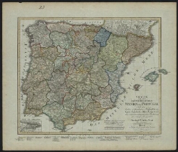
Charte von den Königreichen Spanien und Portugal
Charte von den Königreichen Spanien und Portugal
| Autor | Streit, Friedrich Wilhelm, 1772-1839 |
| Nome do Editor | Geographischen Instituts |
| Língua | Alemão |
| Data de publicação | 1809 |
| País | Alemanha |
-
Chart of the entrance of the river Tagus
Chart of the entrance of the river Tagus
| Autor | Chapman, William, 1749-1832 |
| Nome do Editor | W[illia]m Faden |
| Língua | Inglês |
| Data de publicação | 12th August, 1807 |
| País | Reino Unido |
-
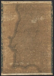
Chorographical map of the kingdom of Portugal divided into its grand provincies = Mappa corografico ...
Chorographical map of the kingdom of Portugal divided into its grand provincies = Mappa corografico ...
| Nome do Editor | W[illia]m Faden |
| Língua | Inglês |
| Data de publicação | 12 th August, 1797 |
| País | Reino Unido |
-
A new chart of the North coast of Brazil from Seara to the Island of Sn. João Baptista
A new chart of the North coast of Brazil from Seara to the Island of Sn. João Baptista
| Autor | Patrício, José, fl. 1809 |
| Nome do Editor | W. Faden, Geographer to His Majesty, and to His Royal Highness the Prince of Wales |
| Língua | Inglês |
| Data de publicação | 1809 |
| País | Reino Unido |